
Community excavations at Manton Lane, Bedford
Albion Archaeology was once again delighted to support the community archaeological project at Manton Lane, Bedford.
The site is located in a known area of late Iron Age and Roman settlement. First identified as such in 2010, it has since only been examined on a small scale and in a piecemeal manner.

Archaeological recording taking place in Trench 1
Local interest in the site resulted in a community project that opened fifteen test-pits/trenches during the summers of 2013, 2014 and 2015. In 2016, a larger excavation area was opened, revealing, among other things, a room with an underfloor heating system (a hypocaust), a collapsed wall and clear evidence that the hillside had been terraced during the Roman period. In addition, in 2017, to the south of Manton Lane, two test-pits were dug within the grounds of Edith Cavell Primary School, where another Roman building was identified.
Excavations this year identified evidence for a Roman building, part of a wider Roman settlement known within the area.
The community project was co-ordinated by Steven Cockings with archaeological direction by Mike Luke and administrative/finds work by Elizabeth Slayer. Thanks are also due to Bedford Borough Council for their support, and RC Care Homes who permitted the investigations to be carried out on their land.
However, this was very much a community project and we would therefore like to thank the dozens of volunteers (local and non-local; first-timers, amateurs and professional archaeologists) who gave up their time to work on the project. Without them, the dig would not have been possible.
A brief report on the results of this years excavations is given below.
Objectives

The location of the 2025 trenches (orange). A previous trench is shown to the south-west and two test pits to the south-east. Manton Lane itself is south and southeast of the trenches.
This years excavations were intended to be the last. The four trenches in the central part of the field were located to link up previously investigated test-pits and areas, improving understanding of the site. Forthcoming work will focus on examining the finds and writing up the results; an essential part of the project.
Results
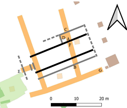
Plan of the hall-type building (main walls in black) and trenches (orange). Letters are the locations of the photographs below.
The 2025 trenches were opened by machine, operated by an experienced driver working under the direction of a professional archaeologist. The topsoil and subsoil were removed and machining ceased when the upper-most surviving archaeological level was exposed. Over the majority of Trenches 1 and 2, this top layer comprised a layer of Roman building debris although this was absent at the north ends of both trenches where the natural clay was present below the subsoil.
Roman structures and features were identified and investigated, including: a hall-type building, a yard-type surface and a boundary/drainage ditch. A small number of other miscellaneous Roman features, along with medieval and post-medieval features, were present.
Hall-type building
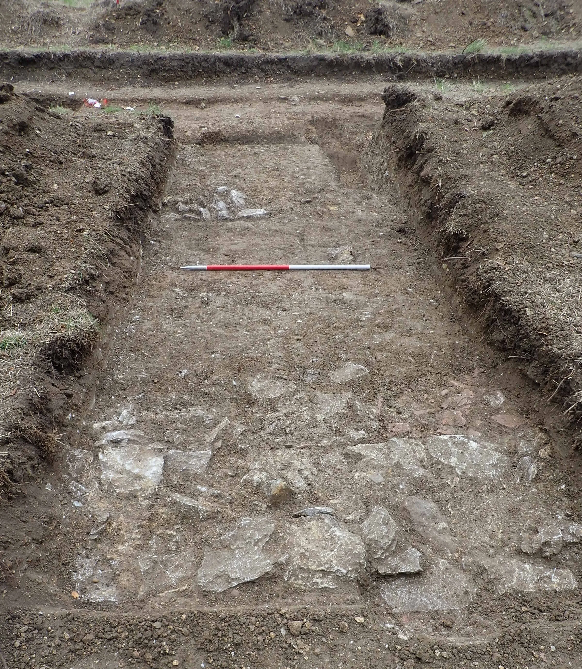
A previously unknown Roman building was identified within Trenches 1 and 2. Its general location was indicated within the trenches by the presence of Roman building debris, with the precise location of its walls indicated either by in-situ masonry or robber trenches (where the masonry has been removed for use elsewhere). Overall, the building was c.28 x 13m in extent.
“Main” walls
The evidence for the “main” walls were two parallel robber trenches 6.5m apart found in Trenches 1 and 2. The robber trenches were 0.9m wide, dug 0.4m into the natural clay and with flat bases. A thin mortar layer was found adjacent on the north side of the southern robber trench which may represent debris that built up during wall construction.
Corridor
Two metres south of the southern main wall was an additional parallel robber trench, found in Trenches 1 and 2. It was 0.6m wide and dug 0.1m into the natural clay. This area would appear to represent a corridor or veranda.
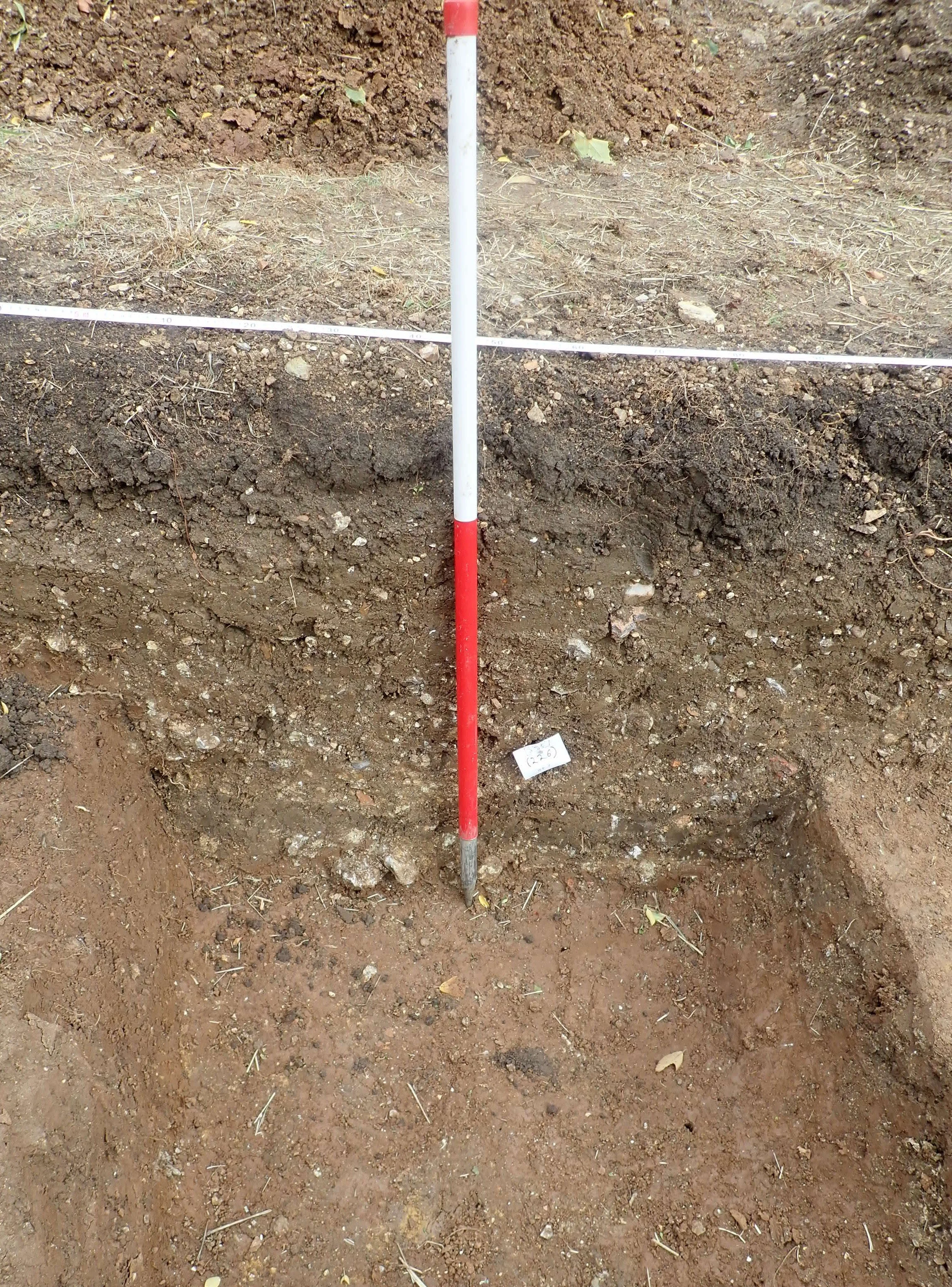
Robber trench of the southern “main” wall of the hall-type building (Trench 2, location A on plan above)
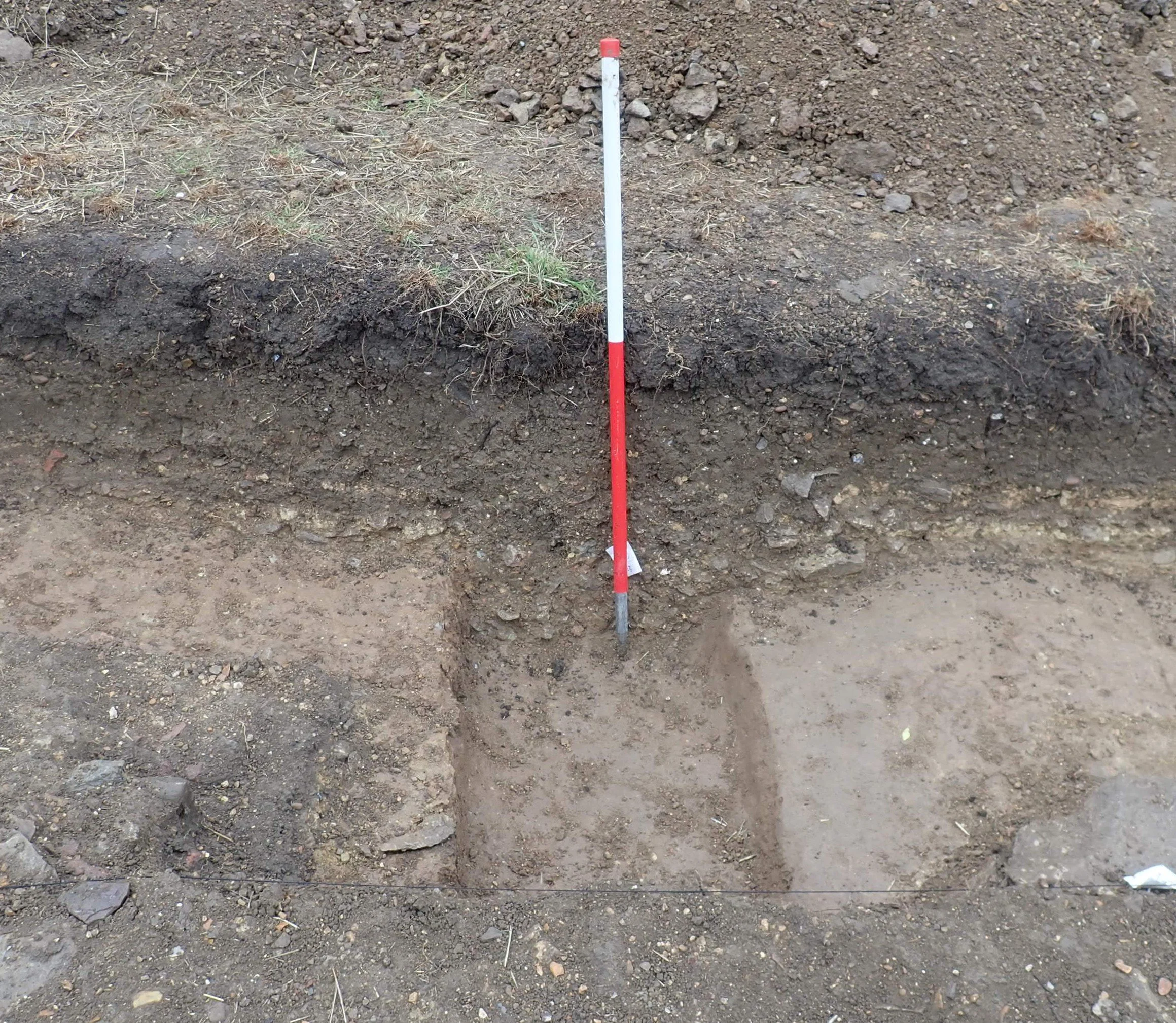
Robber trench of the south wall of the corridor (Trench 2, location B on plan above)
Room/s to the north
In-situ masonry, present in the northern part of Trench 2 indicated the presence of at least one room to the north of the main wall of the building.
An east-west aligned wall comprised one layer of stone footings, above which there were two courses of stones. The coursed stones had been mortared. A thin mortar layer was found adjacent on the north side of wall which may represent debris that built up during wall construction. Stone footings on a north-south alignment survived robbing and are presumed to represent the west wall of this room. The nature/size of stones used and their arrangement is similar to the footings below the masonry wall.

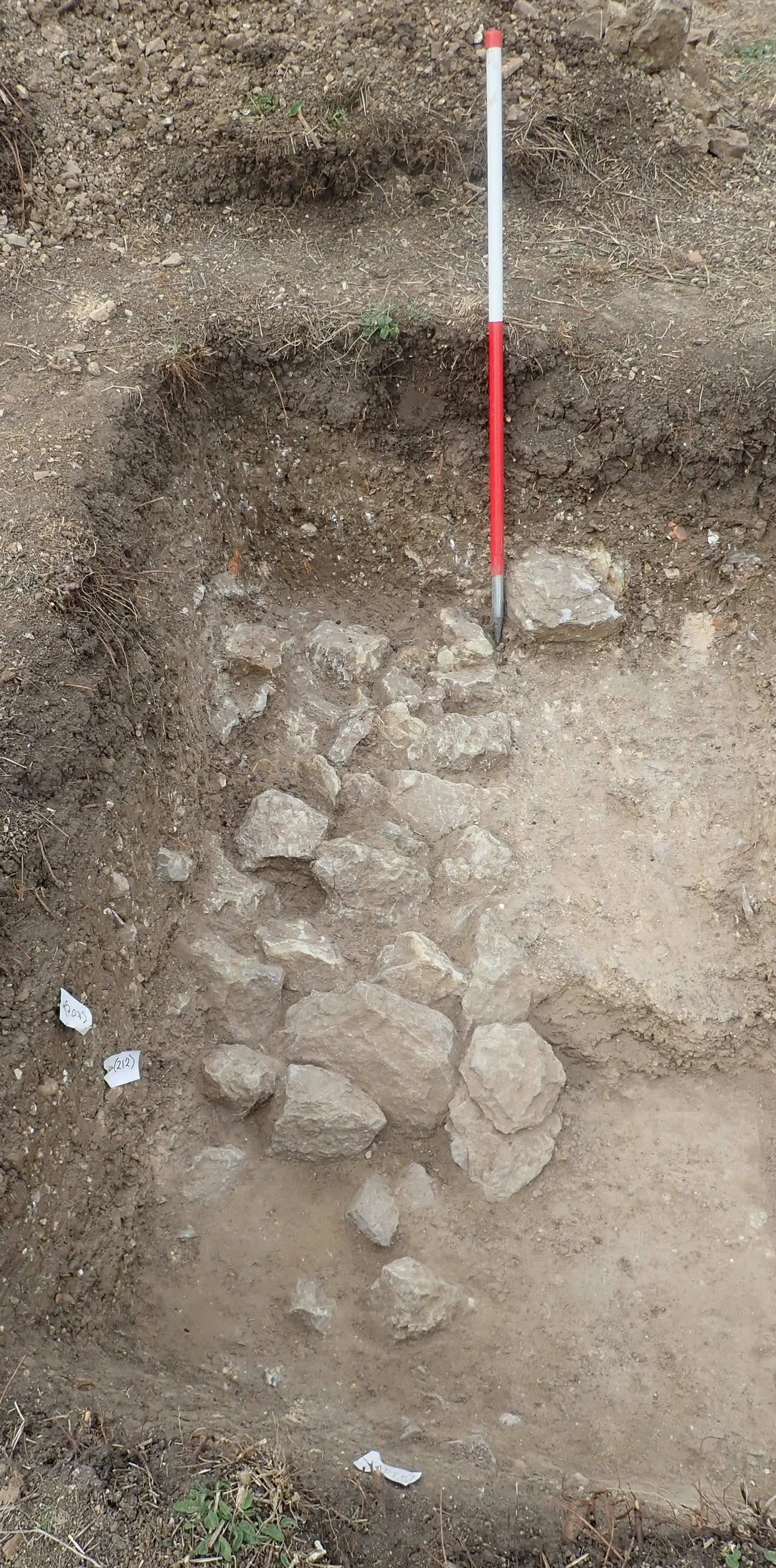
Stone footings and courses of the wall (Trench 2, location C on plan above)
North-south aligned wall footings in Trench 2 (location D on plan above)
Possible west end wall
Before backfilling, a box was machined out westwards from Trench 1. At the west end of this box, a masonry wall was found that is likely to be the building’s west wall. Also within this box was another area of stones, as well as the full width of a robber trench-type feature, which was fully exposed along the west side of Trench 1. The robber trench-type feature was at least 1.2m wide; much wider than any wall robber trenches, and it is therefore possible that it is associated with the robbing of a ‘culvert’ found to the west within the 2016 open area investigation.
Terracing
Changes in the levels of the natural clay on either side of the walls suggest that a series of terraces were dug in advance of building construction. This was especially notable with regard the room to the north of the main wall of the building.
Masonry wall at the west end of the extension to Trench 1, possibly marking the west end of the building (location E on plan above)
Stone pads/postholes (Trench 2, location F on plan above)
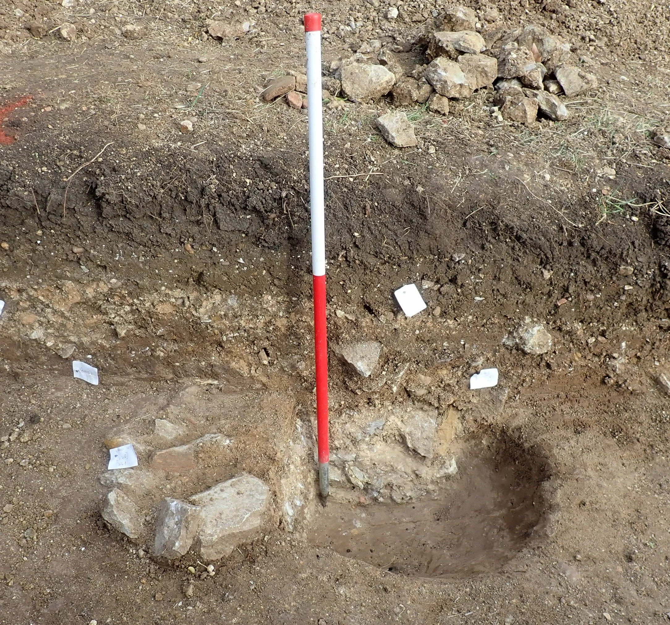
Stone pads/postholes
Two sub-circular features were dug into the natural clay c. 1.5m south of the north main wall of the building. These contained stones that were mortared together and are therefore likely to be structural features associated with the building. They were sealed by the building debris layers (see below).
Floors
No floors or obvious floor make-up layers were identified.
Building debris layers
Building debris layers comprised of small-medium sized stones, lumps of mortar and broken Roman roof tiles, roughly corresponded to the area of the building. The nature of these layers was slightly different between different walls. In places these layers sealed dumps of more coherent mortar which lay directly on the natural clay and which were perhaps, related to the construction of the walls.
Initially it had been assumed that the building debris layers represented collapse/demolition layers of the building. However, the absence of any evidence for floors beneath them, the way that they had different compositions between corresponding walls and the small quantity of domestic debris present, leads to the possibility that these were make-up deposits, dumped in after the walls were at least partially constructed. The make-up would have been used to level the surface and enable a horizontal floor to be constructed, which would otherwise have not been possible as the building was constructed on a hillside. The material would have been derived from the destruction of a presumably nearby building.
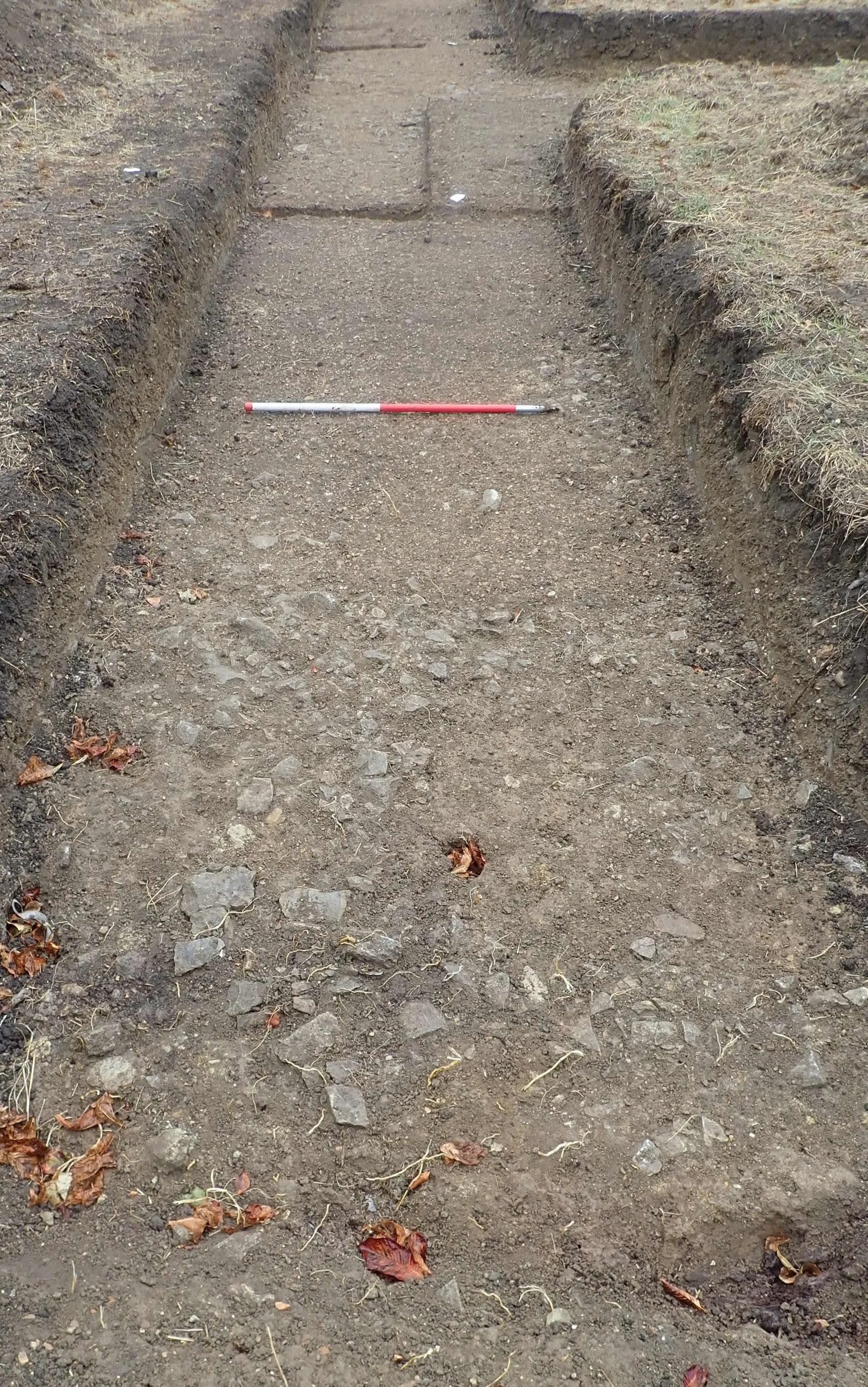
Yard-type surface
Stone and gravel surface at the east end of Trench 3 (location G on plan above)
To the south of the hall-type building was an external surface comprised of small stones and in places gravel.
It was present within the entirety of Trench 3 and had previously been observed to the east in a test-pit dug in 2014. Therefore, its overall extent was at least 35m E-W. It was also probably observed in a test-pit dug in 2015 which would suggest that it was over 10m N-S.
Where excavated it appeared to have been laid directly onto clay and so formed a sloping surface.
The yard surface could be seen in Trench 1 and Trench 2, extending northwards to within 2m of the hall-type building (see plan on last page). In Trench 2 the edge of the surface was abrupt with no evidence to explain this sudden termination. However, mortar and sand layers were present between it and the hall-type building. These may indicate that a threshold or step arrangement into the hall-type building had been present in this area.
Boundary/drainage ditch
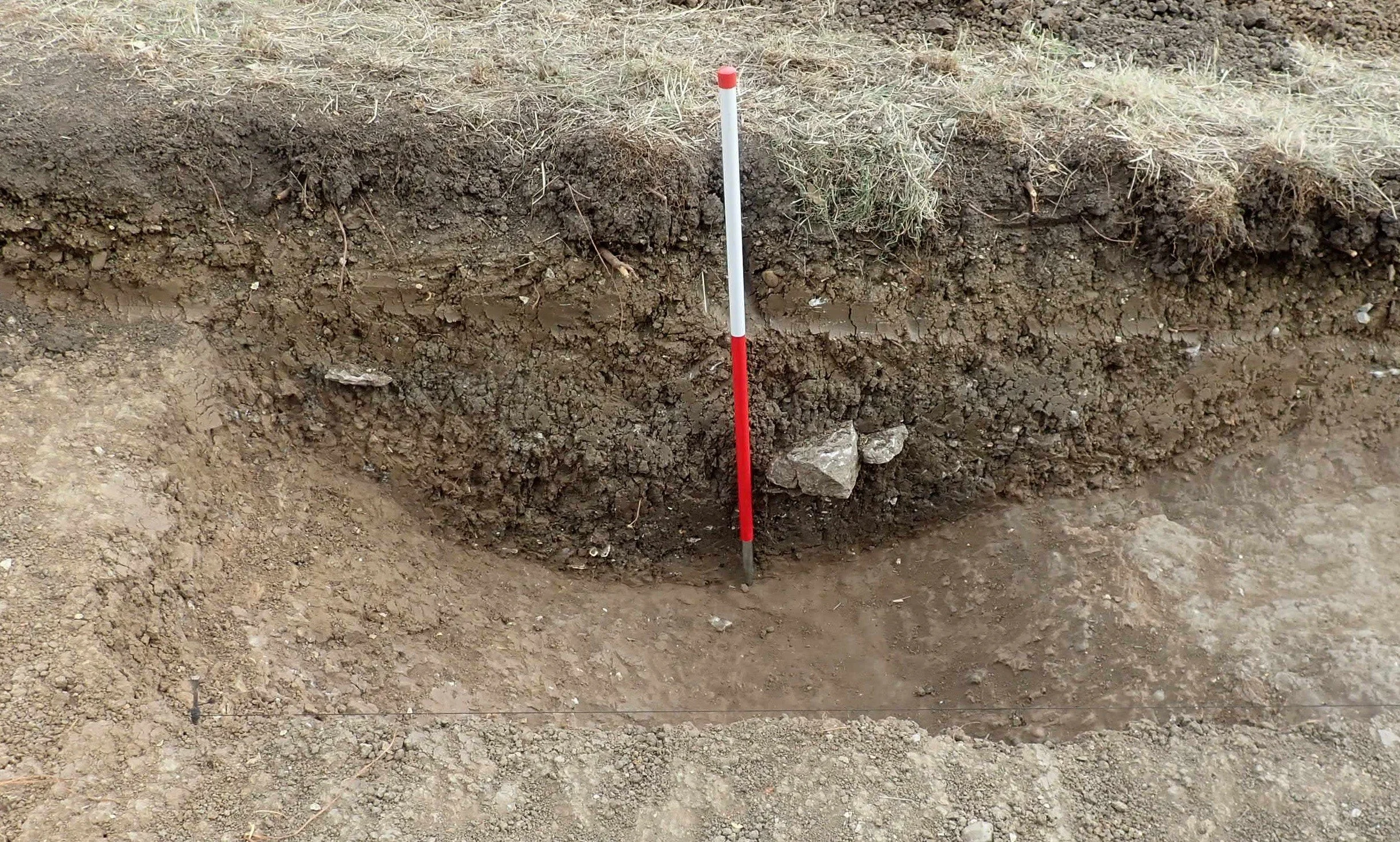
Boundary/drainage ditch (north end of Trench 1, location H on plan above)
Approximately 7m north of the hall-type building a ditch was present. A segment across it was hand-excavated in Trench 1 where it was found to be 2.5m wide and 0.7m deep. The same feature continued into Trench 2 but only its upper fills were excavated. The location and size of this ditch suggests that it served a drainage purpose but it may also have been a boundary and thus is likely to have had an adjacent bank/hedge.
Other features
Only a small number of other Roman features were observed. These included a possible posthole to the south of Trench 1 and a ditch/pit at the west end of Trench 4. The interpretation of the latter is hampered as only a small part of it was present with the trench.
‘Dirty’/redeposited clay
Pure natural clay was not always observed below the building debris layers and yard surface. Instead, a ‘dirty’ clay was present which in places contained pottery and animal bone. While it seems possible that this material may represent redeposited clay dug out when the terraces were created and dumped slightly lower down to level up the slope, insufficient deposits were observed within the trenches to be certain.
Medieval features
Ridge and furrow survives as earthworks within the field. These are represented as variable depths of subsoil within the trenches.
Post-medieval features
Land drains were present at the base of the furrows and a number were partially hand-excavated where they were dug through the yard-type surface to provide an insight into its construction and depth.
A strange sub-circular feature was present within the area of the Roman building in Trench 2. This was filled with clay and may have been defined by loose stones and Roman roof tile. Although uncertain it may have been a possible garden feature associated with Bedford Lodge (a large house shown on the 1st edition OS map that would have been located to the west of the site).
One of the robber trenches of the Roman wall was clearly dug in the post-medieval. This is because stratigraphically it was dug into the subsoil and it can be observed crossing ridge and furrow earthworks both on the ground and on aerial photographs. Its fill also contained post-medieval finds.
Discussion
Hall-type building and adjacent yard
This year’s fieldwork located a previously unknown Roman building. The majority of the walls have been robbed out but masonry survives in a number of discrete areas (always under the medieval ridges). Based on the current evidence, a number of terraces were dug into the hillside to help with the construction of this building. No floor levels were identified within the trenches. This is likely to be because even with terracing, the slope of the ground would require considerable make-up to ensure that the floors would be level. Therefore, any floor levels and destruction material would lie above the level of the uppermost surviving archaeological levels - in effect these will all have been removed by later activity including ploughing.
Based on its size and layout, this building is described as being hall-type. The new building at Manton Lane has similar dimensions to buildings 2 and 9 found within the villa complex at Bancroft, Milton Keynes (Williams and Zeepvat 1994, fig 66). There is no evidence that it was an aisled hall building.
The presence of an extensive yard surface can also be matched with the situation at Bancroft where extensive cobbled and paved areas were present (Williams and Zeepvat 1994, fig 66). As at Manton Lane these will have provided access to the buildings and hard-standing adjacent to them.
The site in its wider context
There is no firm evidence to suggest that the hall-type building served anything other than a utility/storage function. If the debris layers within it are makeup material derived from a nearby building that had gone out of use, they are not construction debris related to the hall-type building. Irrespective of that having a large building with substantial masonry walls is of significance in its own right. Such buildings are known within villa complexes e.g. Bancroft (Williams and Zeepvat 1994).

Some of the Roman buildings at Manton Lane may have borne a resemblance to this building (by Cecily Marshall)
While it is never easy to determine the precise ‘status’ of Roman settlements on the basis of limited investigation, the presence of stone buildings at Manton Lane is in contrast to the timber buildings found within the numerous farmsteads excavated in the Bedford area, e.g. Biddenham Loop (Luke 2016, 241–64) and North of Biddenham (Luke and Barker 2022).
Other buildings have been found at Manton Lane with masonry walls, painted plaster and window glass. These are located to the west (continuing into Bedford Modern School) and to the south within the grounds of Edith Cavell School. The building to the west also had at least one room with a hypocaust and had been decorated with the highly unusual type of stucco work.
In the past, the mere presence of masonry walls and hypocausts has been taken to indicate the presence of a villa, i.e. a complex of highly ‘Romanised’ buildings where the owners of large and wealthy agricultural estates lived. It is now recognised that not all settlements with masonry walls and hypocausts necessarily have to be interpreted as villas. For example, the bathhouse at Newnham (Ingham et al. 2016) and the aisled building at Shefford (Luke et al. 2010) may be associated with estate centres rather than villas.
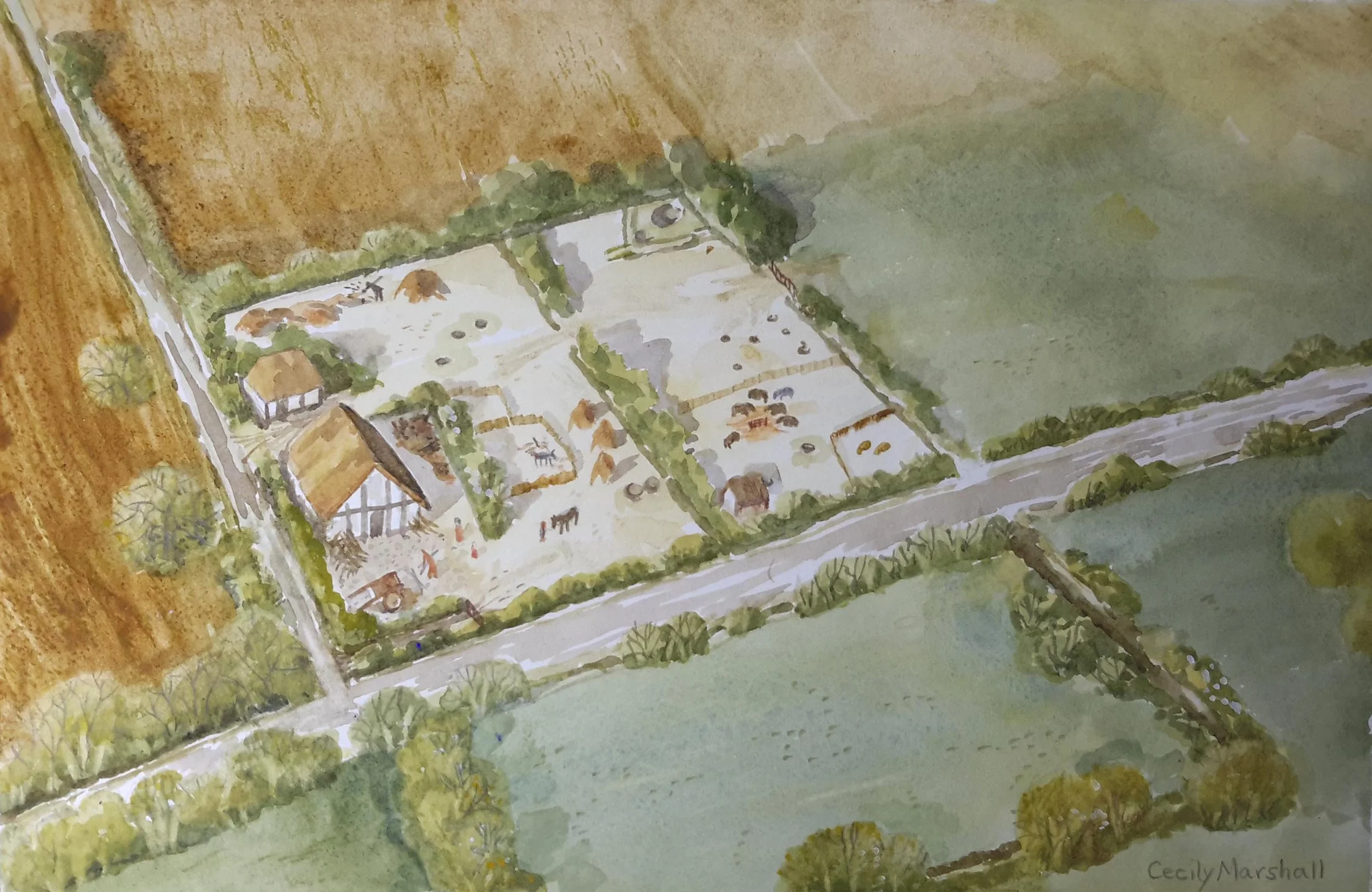
Reconstruction of a Roman farmstead with timber buildings, a more commonly found building type in the Bedford area
At the time of her study of the Middle and Upper Ouse valleys, Meade concluded that ‘there were no proven villas’ in the Bedford area (Meade 2010, 47), which is in marked contrast to the number of villas found in both the Milton Keynes area and the Nene Valley.
Extent
It is important to remember that the land where the community investigations have taken place is just one part of a much larger Roman settlement. Roman remains and finds have been found within test-pits dug within Bedford Modern School (by the School Archaeology Group), evaluation trenches and watching briefs within Edith Cavell School, and a watching brief associated with the widening of Manton Lane (all by Albion Archaeology). This evidence suggest that the Manton Lane Roman settlement extended over at least 2.5ha.
Conclusions
Irrespective of whether the remains at Manton Lane represent a villa complex or something else, this Roman settlement is clearly significant as it contained masonry buildings, some with significant architectural embellishment, and was located in a dominant position within the landscape (a hilltop over the River Ouse Valley).
References
Ingham, D., Oetgen, J. and Slowikowski, A., 2016 A Roman estate centre at Newnham, Bedford, East Anglian Archaeology 158 (Albion Archaeology)
Luke, M., 2016 Close to the Loop: landscape and settlement evolution beside the Biddenham Loop, west of Bedford, East Anglian Archaeology 156 (Albion Archaeology)
Luke, M. and Barker, J., 2022 Land north of Biddenham: investigation of a Neolithic to post-medieval landscape north-west of Bedford Albion Archaeology Monograph 8
Luke, M., Preece, T. and Wells, J., 2010 ‘A Romano-British aisled building and associated settlement south of Ampthill Road, Shefford’, Beds. Archaeol. 26, 269–346.
Meade, J., 2010 The Middle and Upper Ouse Valley in the Late Iron Age and Romano-British Periods: Divergent Identities, BAR British Series 512
William, R.J. and Zeepvat R.J., 1994 Bancroft: a late Bronze Age/Iron Age settlement, Roman Villa and Temple-Mausoleum